
Object-Oriented Land-Cover Mapping of CAP-LTER using High Resolution Aerial Orthophotography
Poster Number:
74
Presenter/Primary Author:
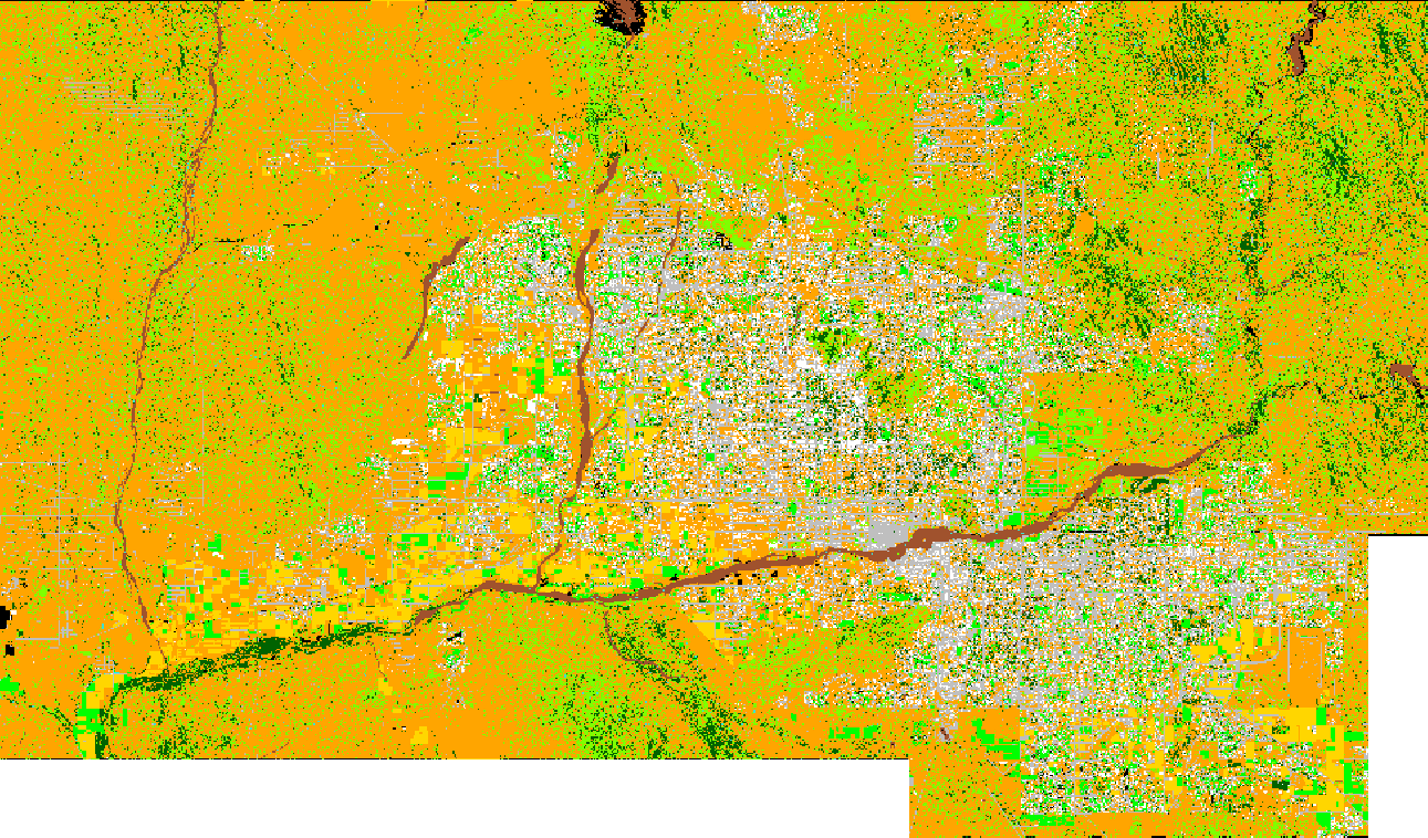
Xiaoxiao Li High spatial resolution imagery is useful for a variety of research endeavors undertaken by the CAP-LTER. Parts of the site have been assessed using expensive QuikBird data. To reduce costs but cover the entire LTER area (and more), the Environmental Remote Sensing and Geoinformatics Lab undertook a land classification assessment with NAIP data. Such assessments are not without difficulties. Traditional classification algorithms confront various issues regarding the precise delineation of land-cover types and object integrity, especially in the heterogeneous urban landscape. To confront these issues, an object-based method for land-cover mapping with 1m resolution aerial photography for Central Arizona-Phoenix area is used. Considering the spectral resolution limitation of the aerial photography (three visible bands only), hierarchical classification networks were established to discriminate land-cover classes at different levels, and a series of decision rules were generated for different types of landscapes (i.e., urban, suburban, rural, desert-mountain, and agricultural areas). Within developed urban areas, images were initially separated into residential and non-residential parts using cadastral parcel GIS data as masks, and the image segmentation was based on each of the cadastral parcels at the upper level to reduce the misclassification between house and soil. Image objects with similar spectral information were compared with their neighbor objects and their super-objects and sub-objects in terms of their spectral response, spatial relationship, geometry, and texture characteristics for their class identification. Land-cover mapping in the desert-mountain areas made use of the GIS data in terms of water lines and road lines. The object- based classification results achieved a higher overall accuracy than using pixel based classification method. The weakness of land-cover mapping with high spatial resolution true color aerial photography can be reduced by using object-based method along with ancillary GIS data.
Related Materials and Graphics: